
In the novel Madame Bovary by Gustave Flaubert, Emma Bovary does something that may sound as familiar to some of you as it does to me. She lives in the countryside, but she wants to be in Paris. So what does she do?
She bought a plan of Paris, and with the tip of her finger on the map she walked about the capital. She went up the boulevards, stopping at every turning, between the lines of the streets, in front of the white squares that represented the houses.
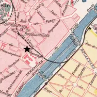
Madame Bovary was written in the 1850s, and the plan Flaubert had in mind was probably much like this reprint that Norman and I found in the bookstore in the Hotel de Sully (an excellent source of books on Paris).

With this book, I can trace Emma Bovary’s imaginary steps with my own finger. This is Paris in the early days of its Haussmann transformation, a city with 12 arrondissements, halfway between the medieval and the modern. It is a conventional map in book form, the precursor to today’s version of Paris par arrondissement. It shows public buildings and churches, palaces and schools. But the blocks containing the houses are just “white squares.”

(Note that the 4th arrondissement in the 1850s does not correspond to the 4th arrondissement of today.)
Emma’s longing for Paris might have been all the more inflamed if she’d bought a bird’s-eye view map. The best known is the immense Turgot map of 1739. This past April, at the Salon international du livre ancien in the Grand Palais, one of the booksellers had a huge coloured version of this map mounted on the back wall of his booth. I was so entranced by the map, I could hardly tear myself away. Here, for example, is the Palais Royal.

Unlike today’s maps, north is towards the bottom left, not at the top.
The detail is extraordinary. There are wonderful little touches that you notice only when you have your nose right up against a full-sized version. Look at the space between the western end of the Tuileries Gardens (at the top) and the eastern end of the Champs Elysées (at the bottom).

The Place de la Concorde has not yet been created, and the space is just an extension of the Gardens, separated from them by a “Pont Tournante” over a little moat. Where the grand buildings of the Crillon Hotel, Automobile Club, and Hôtel de la Marine stand today, there seems to be a lumberyard. Look at the riverside. There are boats and what appears to be a row of lanterns. A grand gate marks the entry to the Cours la Reine – a riverside promenade. It was still there in Emma Bovary’s day.
Turgot’s is the most famous, and probably the most beautiful of the bird’s-eye view maps of Paris, but by no means the first. The Bibliothèque nationale de France has published a compendium of Paris maps dating back to the 16th century,* and the very first one reproduced in the book is a bird’s-eye view, dating from 1553. The one shown on the cover here dates from 1572.

Bird’s-eye view maps let you get up close and personal with the historical city. In one sense, they seem like a straightforward approach to early mapmaking: they represented the oblique view of a city from a high church steeple or tower that an artist could presumably draw from life. But in another sense, they are utterly amazing. The mapmaker had to extrapolate that view from a tower to places where there were no high buildings, present everything from a uniform angle, and show buildings realistically while ensuring that streets were visible and labelled.
How did they do it? How did they get it more or less to scale? The amount of work involved must have been staggering. One insight comes from a paper about 19th-century artists who created bird’s-eye views of American towns in the traditional manner:
[The mapmakers] did not go up in hot air balloons or strap miniature cameras to pigeons or kites to gather information for their panoramas. Instead, they stayed firmly on the ground drafting a street map in perspective based on a grid. Next, they walked through the town sketching the facades of buildings that would appear from the viewing direction that they had chosen. Finally, they drafted the final panorama, filling in detail from the building sketches they made in the field.**
I assume that is how the Parisian mapmakers proceeded: plan, sketch, assemble. But Paris is huge. The enormous Turgot map took two years to create.
Michel-Étienne Turgot didn’t do it himself, but it was his idea. He was the Prévôt des Marchands (Provost of the Merchants, which I assume is like the head of the city’s Board of Trade) and he wanted the map as publicity for the city. This was an early exercise in city “branding.”
Oddly enough, in the 1730s, when Turgot had his idea for a huge map, bird’s-eye views were rather out of date. This was the era of flat, two-dimensional maps that look surprisingly like satellite views, thanks to improvements in surveying techniques. But Turgot wanted something beautiful, something that showed the details. He bypassed professional mapmakers in favour of Louis Bretez, a member of the Academy known for his architectural drawings and paintings.

It was quite a commission. The map is oriented towards the southeast, so most monuments are shown at an angle, not straight on. Although Bretez taught perspective at the Academy, he was instructed to depict all buildings at the same scale, wherever they were located. So there is no vanishing point on this map, no horizon. The scale was 1/1400 and Bretez was given carte blanche to enter buildings so he could sketch the courtyards and interior facades. It sounds like a dream assignment.
Bretez toiled from 1734 to 1736. He probably relied on existing surveys and maps for most of the underlying plan and focused on the architectural details. When he was finished, it took another three years for the engravers to make the plates (the map is in 20 sections) and print them. Then Turgot distributed the map to everyone who was anyone in European trade.
Turgot thought big. When the 20 sections were assembled, the final version was about 10½ feet wide and 8 feet high. The one at the book fair was the original size and looking at it, I felt I could almost climb inside Paris of the 1730s. The best indication of the map’s size is shown in this fashion shot from Harper’s Bazaar in 1951. The model is holding the portfolio that would contain the 20 sheets.

Emma Bovary would have loved it. Eat your heart out, Google Street View.
Text and original photographs by Philippa Campsie.
* Pierre Pinon, Les Plans de Paris: Histoire d’une capitale, Bibliothèque nationale de France, 2004.
** Tom Patterson, “Looking Closer: A Guide to Making Bird’s-eye Views of National Park Service Cultural and Historical Sites,” Cartographic Perspectives 52, Fall 2005.


As someone who loves maps, i found this a wonderful piece. Like Emma, I was tracing my walks on the screen. Thank you so much.
Wonderful post! I love studying old maps, paintings, photos, and drawings of Paris. It is so much more meaningful now that I am familiar with the city, and have walked so many of the streets myself. Thanks for the entertainment.
I find myself constantly looking at my little map guide of Paris…picking one area and trying to learn the street names and locations so that on my next trip it will seem familiar to me. Love this article….love all the Parisian Fields blogs…You two do a fabulous job of sharing ‘our’ city. Merci!
Tremendous Philippa!! I too love old maps since they fill in one’s understanding of how an area developed. Thanks a lot!
Ken Bowes
This was a wonderful post! There’s a new 3D reconstruction available on the web, but nothing can touch these old maps!
Hi Patricia, which 3D reconstruction site are you referring to? Many thanks.
Oh these are my favorite–I’ve sat for hours looking over the old maps of Paris..especially the early 18th century ones. While living in Paris last summer I actually used them to find houses of some of my favorite French characters–from Voltaire to Napoleon. They are so fascinating. Thanks for sharing.
I have an old map of Paris and her “monuments” printed on oil cloth hanging in my studio. I use a small map book when in Paris and probably won’t ever migrate to a smart phone map or GPS until there are no longer printed map books. I can look for hours at street maps, especially the old ones like you have reprinted in this article. Thank you.
Salut! I just discovered your site while researching info on La Grande Roue. I’m an aspiring novelist “inching” my way through a chapter about a woman in a horse-drawn ‘taximeter’ riding through Paris. Needless to say, I wish I had Turgot’s map:) At least, I do have a 1911 tourist book with the map folded inside. I’ve signed up to receive your blog posts. I can’t thank you enough. Wonderful information so rich in detail.
Pingback: Turgot map of Paris is like Google Maps of the 1790s | by Tim Grubb
Thank you. This was a great background piece. We’re in Paris right now looking around for some maps (repros) to take back. Found a great shop on rue Francois Mirron. Pondering whether to buy the pretty big Turgot map they have. We can’t carry it. Can we send by post? Dunno. But I love knowing more about the history.
Last year, we bought a book with good-quality reproductions of the whole thing. Louis Bretez, “Plan de Paris dit Plan de Turgot, 1734-1739,” Editions Feuilles, 2013. We found it in a bookshop on the rue Bonaparte, just south of the Place St-Sulpice, although we have seen it in other bookshops. Fold-out maps and lists of streets and monuments. It satisfied my need to own the map, even though we haven’t the space to display it.
Philippa
Ah, rue Bonaparte. That would be a good place to look too. Good idea! Tho we may just stick with that shop on rue Francois Mirron. Plan to measure our suitcase (or bring it) to be sure the tube fits. Thanks for your advice.
Pingback: The lost neighbourhood | Parisian Fields